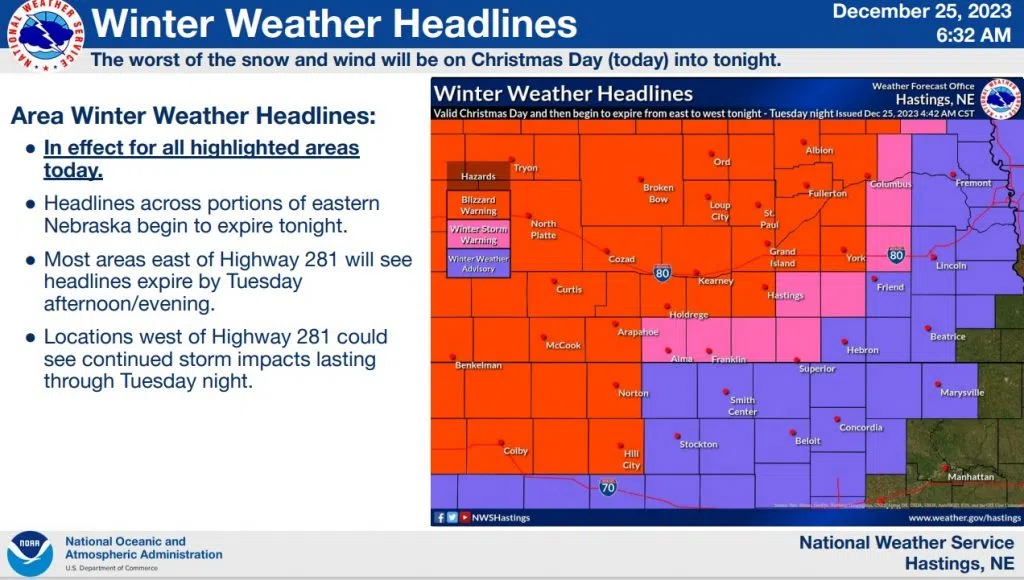
Nebraskans wishing for a White Christmas have seen this wish come true. A strong upper level trough through the center of the country along with a two surface lows and a long cold front are working together to pull moisture from the south into the central plains. Blizzard warning continues through Tuesday Night.

Low pressure is expected to move north through Iowa then move back into NE Nebraska before shifting southeast Tuesday as it then heads east. Winds expected to gust to 40+ mph through Christmas day and begin to decrease through Tuesday and Wednesday.

There is a long stream of moisture being pulled in from the Gulf of Mexico and through the Southeast from Florida to the Great Lakes and back into the central plains. Often time when these storms get this large they tend to break up and the moisture stream gets split. That will determine the amount of snow central Nebraska will see and something to watch.

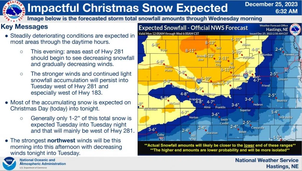
Snowfall estimates look for larger totals north of I-80. Drifting snow will see wide variety of snow totals. Storm is expected to exit by late Tuesday with a quieter and dry forecast into the new year. Travel not recommended. For the latest Road Conditions check with 511 Nebraska.
Closings and Cancelations are displayed on the Central Nebraska Today Closings Page.


