

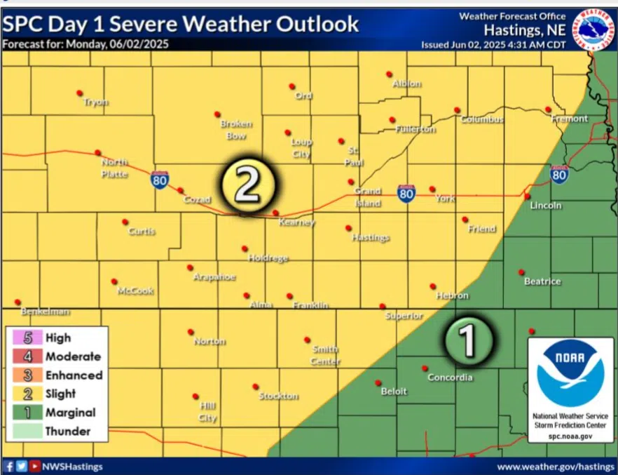
Slight Risk for severe weather issued for Monday, June 2, (NWS Hastings, Courtesy)
HASTINGS — A Slight Risk for severe weather has been issued across all of central Nebraska during the late afternoon and evening hours of Monday, June 2. Locally, heavier rainfall is possible.
The Storm Prediction Center has issued a Slight Risk, a two out of five, for much of Nebraska, driven mainly by the threat of strong winds and hail, but there is a non-zero chance for tornadoes as well.
According to the National Weather Service – Hastings, southerly flow is in place of the upper-level trough of low pressure that will be responsible for the thunderstorm chances.
This southerly flow will transport moisture north into the area throughout the day with dewpoints rising into the low 50s and mid-60s. Temperatures are expected to climb into the upper 80s and low 90s.
A cold front will move into north central Nebraska during the hours of 5-7 p.m. and will provide the lift needed for thunderstorm development. Instability values are expected to be high, and storms will quickly grow upscale along the front.
Wind shear values are not overly strong but will be enough to support strong to severe thunderstorms. This line will push southeast across the forecast area during the evening and overnight hours.
Per NWS Hastings, the strongest storms will likely occur in the northwestern parts of their warning area during the evening hours. The line of storms is expected to gradually weaken as it moves southeast and loses instability with the loss of daytime heating.
Large hail will be a concern with initial storm development and then will transition into a damaging wind threat over time. There could be a brief spin-up tornado embedded in the line, but this is not expected to be the primary hazard.
Scattered to widespread showers will continue through the overnight hours will bring heavier rainfall to the area. Most of the area is expected to receive around 0.5 to 1.0 inches of rain. There could be locally heavier amounts of 2-4 inches where strong storms track.
The areas favored to see the heaviest rainfall have the highest probabilities are roughly along a line from Lexington to Fullerton. Chances for rain will slowly come to an end from northwest to southeast as the cold front pushes into eastern/southeastern Kansas.